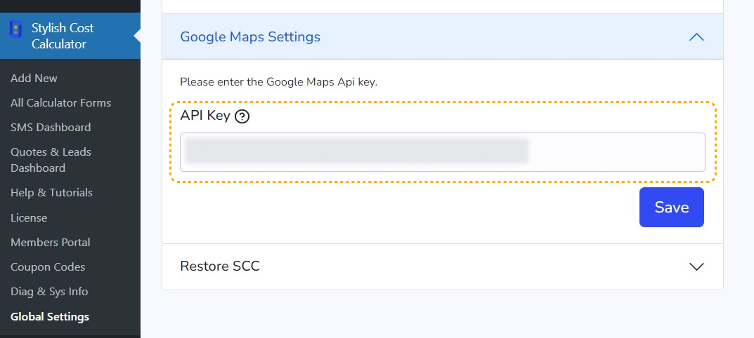
Step 1 . API Integration
First, add the Google Maps API to the global settings page of the Stylish Cost Calculator.
Go to Stylish Cost Calculator > Global Settings > Google Maps Settings

Step 2. Set up your element
Modify or create a new calculator form and introduce the “Distance-Based Calculations” module.
To get started, click on the "+ Add Element" button

Then, click on the "Distance-Based Cost" button to add it

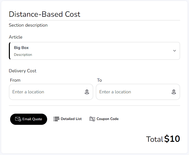
Settings & Options
First, you can set a "Title" for this element, it's gonna be visible on the front.

Second, select the Unit Type ( length unit ) you want to use, kilometers (km) and miles (mi) are available.

Add the price per kilometer or per mile, the calculator takes into account the fractions of km/mi for the final calculation (If your price is $2 per kilometer, half a kilometer will be calculated at $1)

On the advanced options, you can set this element to required if you want to force your customers to select an option. You can also disable "Display on Detailed List & PDF" if you want to hide it in the quote.

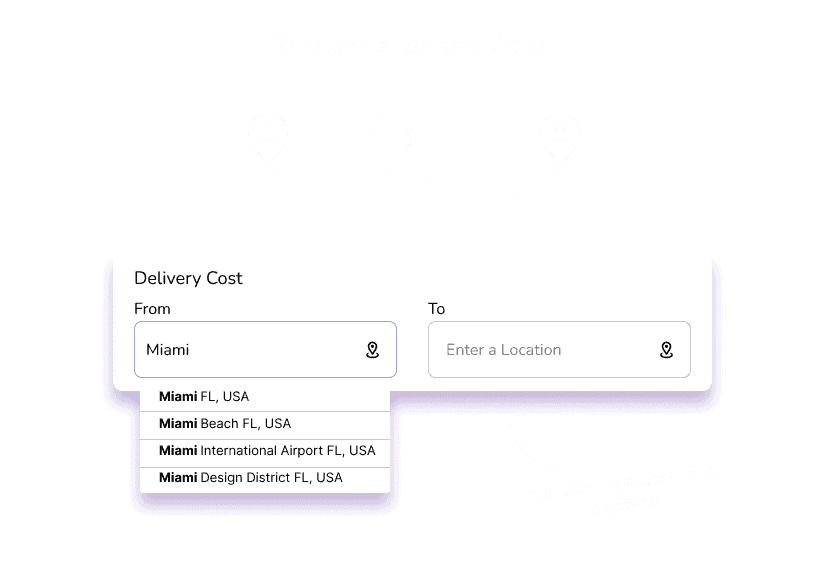
Finally, you can add a default departure address, this will make your calculator show only one field (arrival).